Ribblehead
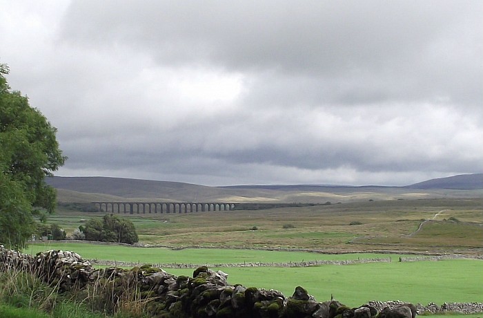
It wasn't raining at home ! Just grey and overcast. By the time we reached the dizzy heights of the Ribblehead viaduct it was spitting with rain, a coffee at The Station Inn saved us from a down pour, then we had to decide whether we were going to walk or not. Yes, we would set off. So, the outward half of the circular walk from Ribblehead was into a head wind and driving rain. The second half had the wind on our backs, and the rain stopped, although the sky never lifted. The landlord in the pub was cautioning walkers not to set out as the cloud would not lift above 1,500 feet that day, but we were not venturing to the peaks, just through the bottoms as far as Chapel le Dale and back again.
Ribblehead
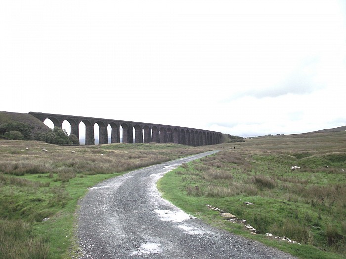
The walk set off through the arches of the viaduct on a very good all weather path to Gunnerfleet Farm. It is quite awesome to walk underneath the viaduct, it is impressive from a distance, but up close it is awesome. The viaduct was built to take the Midland company railway from Settle to Carlisle. At this point it had to cross very unstable ground called Batty Moss. Hundreds of navvies lived in a shanty town in this remote moorland to build the railway and the viaduct with its 24 arches of about 100 feet built between 1869 and 1875. Life was grim. Many navvies lost their lives.
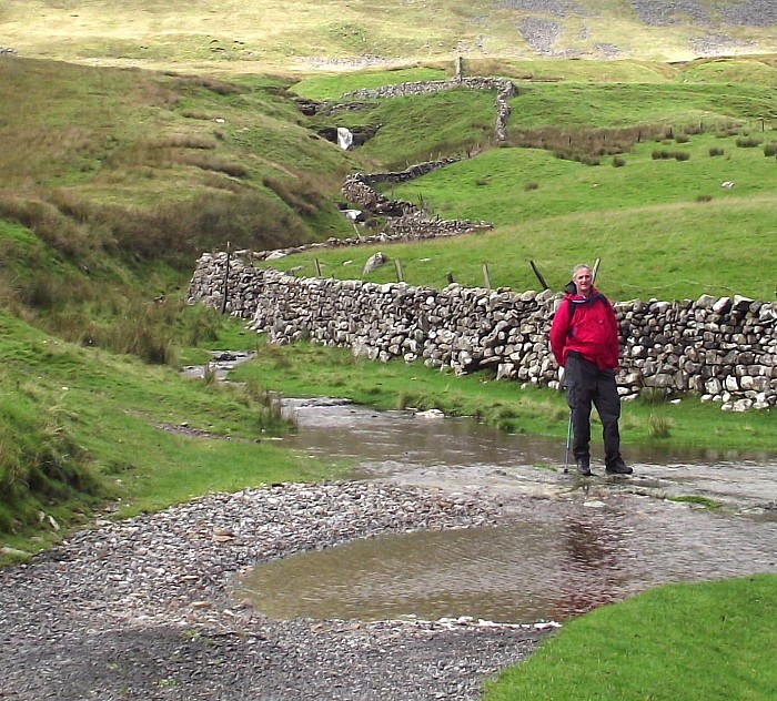
The walk was through good grass land, in fact we were impressed by how much grass the farmers had, and alongside a water course called Winterscales Beck, but it was fast flowing and like a river.
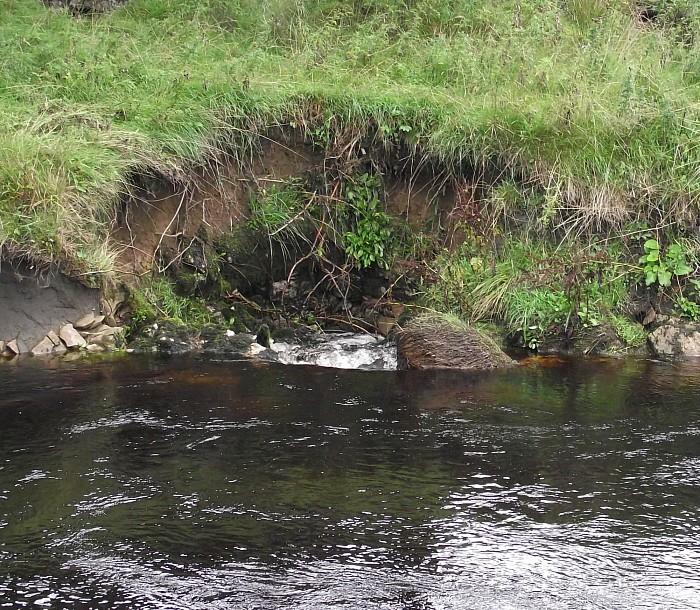
After some distance we left the good track and went across fields, still not far from Winterscales Beck until suddenly - whoomph ! The beck disappeared. One moment a broad fast flowing river, then it went down this hole and was visible no more. This is what rivers do in this part of the Pennines, they appear and disappear out of the rocks. We could hear it crashing far below us as it went underground. The next part of the walk was tricky. We had to walk along the flat stones on what would have been the beck had it not disappeared, and as it was raining they were very slippery. I was glad when we got to the end of that stretch on to Philpin Lane.
After was short distance on the main road, then we turned right into this little lane to Chapel le Dale. Very much off the beaten track it is a quaint little place. Here we stopped for our picnic lunch, it had stopped raining now, so we sat on a bench outside the lovely church of St Leonard's. What a gem. It is very tiny, very old, quite dark inside, but special. Here there is a memorial to the navvies who died when building the Ribblehead viaduct and the part of the Settle to Carlisle railway line that passes through these parts.
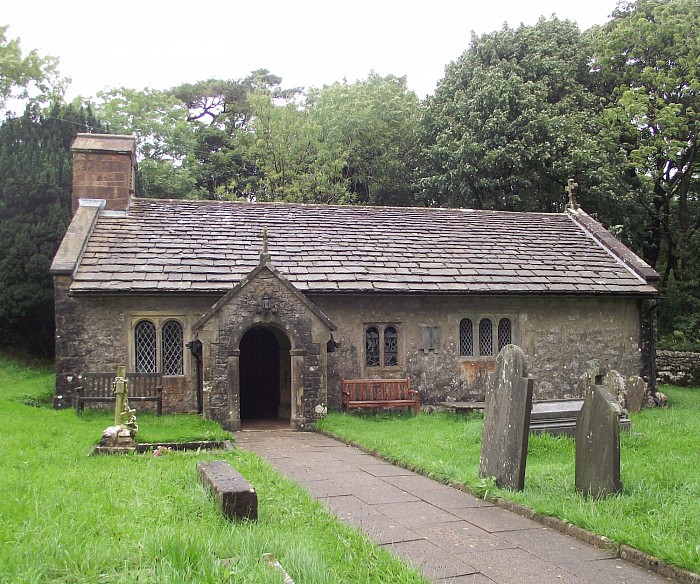
St Leonard's church, Chapel le Dale
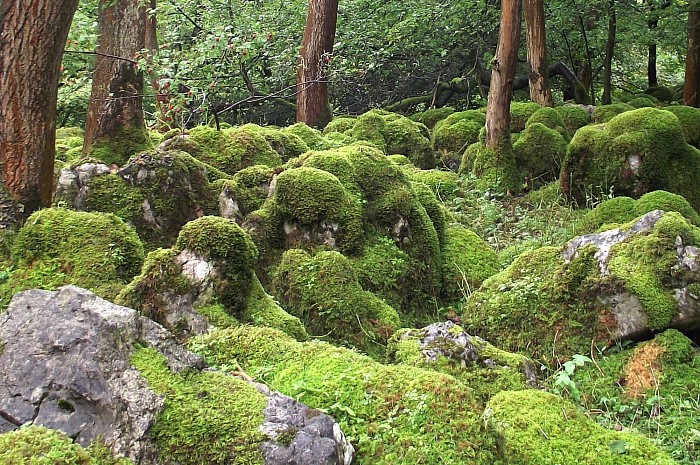
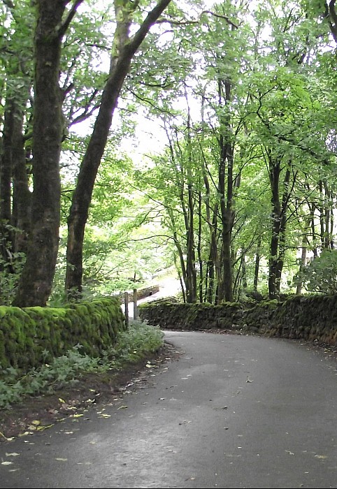
Onward and upward, the next part of the walk took us up a track behind the church, through woods and stones covered in moss. I like moss, I think it is beautiful when you look at it closely. Soon we left the mossy woods and were into open country with limestone pavements and sink holes. The clouds did not lift and Ingleborough kept its cap on.

Ingleborough
Ingleborough is one of the three peaks of Yorkshire. Whernside and Pen-y-ghent are the other two. Ingleborough is 2,372 feet above sea level, Whernside 2,415 feet and Pen-y-ghent 2,277 feet. The Three Peaks Challenge is to climb all three within a 24 hour period. You need to be mad ... but many do it. All three peaks were visible on this walk, or would have been if the cloud had lifted. It did lift a tiny bit and for one fleeting moment we did see Ingleborough.

These outcrops of rock are called limestone pavements, and are in particular parts of the Yorkshire dales. The bare rock is exposed with no soil on it. The slabs of rock are called Clints and the cracks or crevices between are called Grikes. Tiny plants grow in the grikes.
After a short climb up a good track we turned through a farm yard and headed eastwards back towards Ribblehead. From this point onwards it was a fairly level track and good underfoot with views of the distant viaduct.
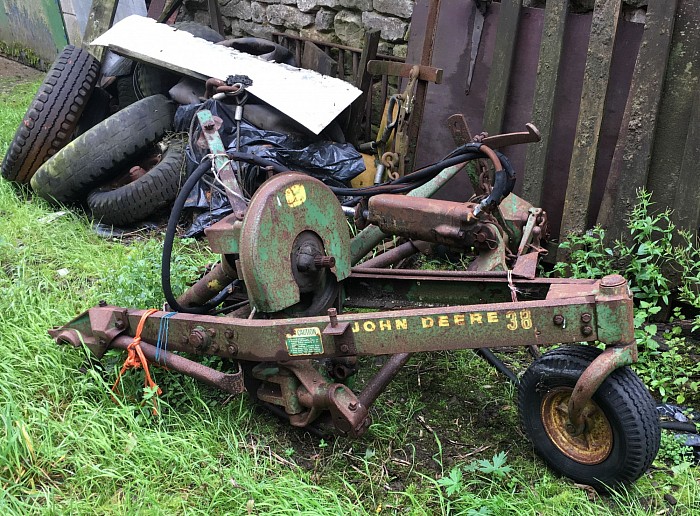
The track took us through lots of farm yards. This holds a certain fascination for someone who is interested in all farm machinery, both new and old. Many farmers can't bear to part with pieces of equipment even when they have fallen to pieces, and a certain person loves the challenge of working out what they were and how old they could possibly be. Who knew that pieces of scrap could be so interesting ? he often photographs them .......